|
By John Pint
 There's
something special about Tapalpa. Meandering through its narrow,
picturesque streets is a pleasure all its own and what better way to
end a day of wandering than in an armchair in front of a roaring
fireplace, sipping a potent Ponche de Granada? There's
something special about Tapalpa. Meandering through its narrow,
picturesque streets is a pleasure all its own and what better way to
end a day of wandering than in an armchair in front of a roaring
fireplace, sipping a potent Ponche de Granada?
Should you have
the time, you might possibly spend a few hours visiting Las Piedrotas,
several huge rocks which look out of place lying in a flat meadow just
outside of town, as if they had been tossed there like peanuts dropped
by a passing giant.
The Piedrotas have been turned into a
tourist attraction in recent years but actually they are mere pebbles
in comparison with La Piedra Gorda, a monolith located only four
kilometers away, but a bit difficult to reach, so that few people ever
visit it, although the view from its peak is well worth the effort.
Twenty
some years ago I found out why not many have seen the Fat Rock. First
of all, you had to hike uphill for five kilometers and second, you had
to cross a winding stream eight times, hopping from rock to rock and
hoping not to fall in.
Last week I had a chance to revisit the
Piedra Gorda with friends who planned to install a bolt in the rock to
which visitors could attach a safety line while peering over the edge
of a sheer drop of some 50 meters.

We
drove northwest out of Tapalpa to the DIF (Family Development Center),
parked and—of course—immediately came to that famous stream, which, of
course, we crossed by leaping from rock to rock. The altitude here is
about 2092 MASL. Just a few meters beyond the stream I found something
new. The old trail of bygone days had been replaced by a road...well,
maybe I should call it a brecha, because it is rough, full of ruts, and
closed to vehicles (except those of people living in the area). This
road goes up close to the Piedra Gorda taking away the guesswork we had
to deal with years ago. It's also important to note that drainpipes
have been installed under the road in strategic places so now you only
have to cross the river once on your way to the Fat Rock.
Well, as
long as you don't mind walking through mud, mud, and more mud (Don't
worry, it will dry up at the end of the rainy season), this is an easy
hike through a gorgeous forest and you can even nibble on crab apples
along the way. At N19 58.853 W103 48.975 we took a shortcut across a
big curve in the road. This brought us into a charming meadow filled
with wildflowers. Since Tapalpa has a strange tradition causing people
to throw Santa Maria flowers at one another on Mexican Independence
Day, we waged a few battles of our own before crossing the road again
at N19 58.916 W103 49.018. At this point you just head uphill (there's
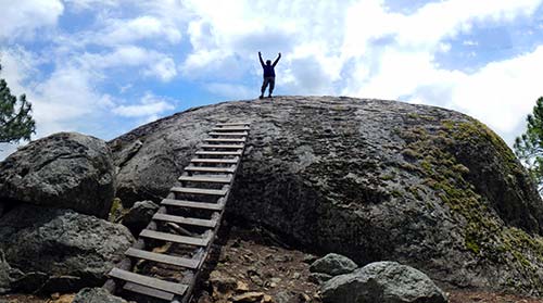
no path) and after 190 meters you'll come to La Piedra Gorda, which is
nestled among a few smaller rocks. There's a sort of ladder here to
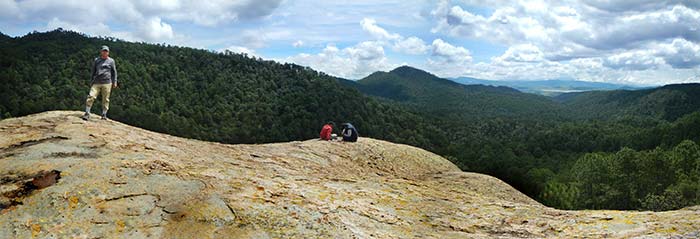
help you get up to the top of the rock where you suddenly come upon a
magnificent, eye-popping view. It's Mother Nature making IMAX look like
a postage stamp! The Altitude here is about 2400 meters above sea
level. The hike is 4.5 kilometers one way and took us about 90 minutes,
strolling along at a leisurely pace.
How to get there
Head
west out of Tapalpa on Camino a San Gabriel. At N19 56.561 W103 46.294
turn right onto Calle Sierra del Tigre and follow it northwest 2.6
kilometers to the Tapalpa DIF building. Continue past it another 480
meters and park at N19 57.326 W103 47.744. You'll find the stream just
180 meters north of you. Cross it and in a minute you'll come to the
brecha. Follow this northwest for 3.9 kilometers, at which point you
can take the above-mentioned shortcut for a pleasant change in scenery.
The Fat Rock is at N19 59.010 W103 49.056. You'll find the entire
route, from Tapalpa to the Piedra Gorda on Wikiloc.com under “Fat
Rock
of Tapalpa.”
|

