|
By John Pint
 “I’m
looking for a little-known obsidian deposit at a place called Las
Pilas,” said geologist Chris Lloyd. “Want to come along?” “I’m
looking for a little-known obsidian deposit at a place called Las
Pilas,” said geologist Chris Lloyd. “Want to come along?”
Our neighbor Rodrigo Orozco decided to join the hunt and off we went
the next day to Santa Rosa Valley, located about 35 kilometers
northwest of Guadalajara and 9 kilometers north of Amatitán.
We ended up at a balneario, entirely deserted. ¡Claro que sí! Everyone
had gone off to the celebration at Chome, of course.
Just below Balneario Las Pilas was a gate. “I know this place,” I told
Chris. “It’s the gate to a tequila distillery called La Taberna...and
it also marks the trail head for hiking to the curious ghost town of
Tequilizinta Mesa.”
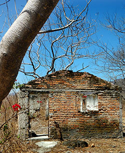
Back in the 1980’s, my caver friends and I had met Don Guadalupe
Hidalgo, “the last resident of Tequilizinta,” where a small religious
community had once flourished, believing this mesa to be one of the
seven places that will be spared at the end of the world. But one day,
Don Guadalupe had told us, everyone in Tequilizinta went off to follow
a new Messiah, leaving him all alone, until his death in 1995.
Don Guadalupe guided us to Las Cuevas Cuatas, two volcanic caves in a
sheer cliff wall just beneath the mesa. These turned out to be the only
lava tubes we have ever found in Jalisco, as well as the subjects of a
few fascinating legends.
The trail to Tequilizinta is two kilometers long. We found it in
excellent condition, immediately suggesting that the ghost town may now
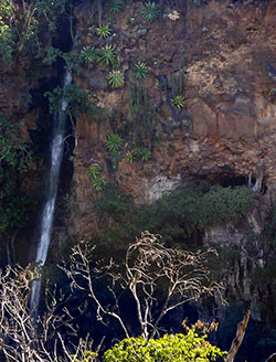
be inhabited. Just 270 meters past La Taberna, we first heard and then
saw a big waterfall on the opposite wall of the long arroyo below us.
Local people say that what’s visible from the trail is only the upper
half of a very tall and impressive cascade.
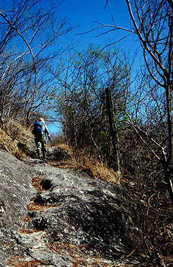
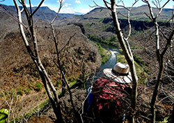
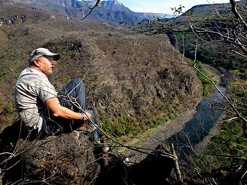
View of the Santiago River Canyon from the Tequilizinta trail.
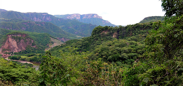
A little farther along
the trail, a dramatic view of the Santiago River Valley opens up, a
truly impressive sight. All the while, of course, Chris was checking
out the rocks and not discovering obsidian. But we were now very close
to Tequilizinta, so we decided to go have a look.
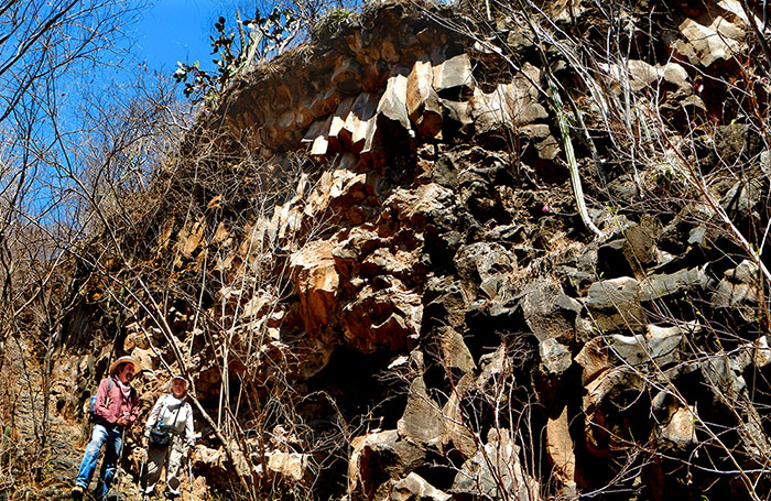
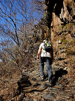
Luis Rojas and Maruca González admire the basalt prisms alongside the final stretch of the trail to Tequilizinta. A few minutes later, we
came to a well-made trail that snakes its way up a vertical wall of
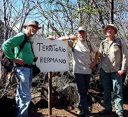
basalt columns. A brand-new sign up at the top announced that we were
now in “Territorio Hermano.” At this moment, two of those hermanos
appeared below us on the trail, each carrying on his back a full
20-liter garrafón of drinking water. They welcomed us to their
community and insisted we come and sit with them in the cool interior
of one of several houses they are renovating. To me it was amazing that
these people come to this lonely mountain top week after week carrying
heavy loads on their backs the whole distance.
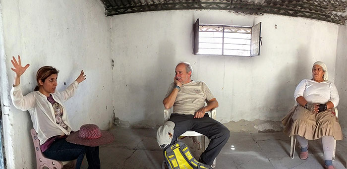
New residents of Tequilizinta Mesa regale Rodrigo Orozco (center) with
tales of weird noises, like “the crashing of ocean waves” they say they
have heard inside Cuata Cave, which they believe will be one of seven
places spared at the end of the world. But now and then they do
get a visitor. “People have appeared here out of the blue, including a
fellow from Japan,” they told us. “guided by a map in a book.” That
map, of course was drawn by Jesús “Chuy” Moreno, proving that
people can actually find isolated spots like this without a GPS.
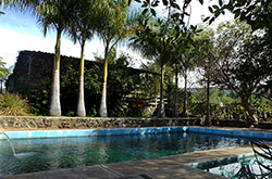
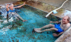
If you
want to hike along the Tequilizinta Trail, be sure to bring bug
repellent and drinking water. You could also bring a swimsuit, because
after your hike you would surely enjoy taking a dip in the lukewarm
waters of Balneario Las Pilas (entrance fee: 20 pesos), where you can
also purchase ice-cold drinks. Believe me, you will appreciate both
services if you decide to visit Tequilizinta Mesa in April or May when
this little valley can get sizzling hot. Las Pilas is usually open
every day, but to be sure someone will be there, call Felipe at
(Cell) 331 996 0042.
How to get there
From
the Periférico, take highway fifteen 35 kilometers north to the town of
Amatitán and turn right onto the fine, signposted road to Santa Rosa.
After about 9 kilometers the road begins to zigzag downward. The first
town you come to is Chome. Continue downhill for about 1.4 km to La
Conchilla. Turn left at N20 54.319 W103 44.303 and drive 1.6 kilometers
to La Taberna tequila distillery. If you stick to the most-used road
you’ll find it easily. Park at the balneario (N20 54.390 W103
44.906)
and walk a few steps down to the distillery gate. Go through (or over)
the gate and walk north 235 meters to the distillery. On your left
you’ll see a cement stairway that seems to lead nowhere. Go up the
stairs, through a space in the fence and walk north a few meters to an
easy-to-cross stone wall. Go over the wall and head north for one
kilometer along a well-trodden path, which will eventually take you up
to an old, open gate. From the gate follow the path northwest to the
settlement (N20 55.172 W103 45.320) on Tequilizinta Mesa. You’ll find
the combined driving-hiking route from La Conchilla to Tequilizinta on
Wikiloc.com under “Tequilizinta Route.” Driving time from Guadalajara
to La Taberna distillery is about 45 minutes and the hike might take an
hour and a half on the way up and an hour on the way down.
|