|
By John Pint
 Mexican documentary
producer Alberto Fuentes recently announced plans for a TV series
featuring natural outdoor attractions within “The Magic Circle” around
Guadalajara, an area including all of Jalisco, Colima and
Aguascalientes, plus parts of other Mexican states. Mexican documentary
producer Alberto Fuentes recently announced plans for a TV series
featuring natural outdoor attractions within “The Magic Circle” around
Guadalajara, an area including all of Jalisco, Colima and
Aguascalientes, plus parts of other Mexican states.
“I call this El
Círculo Mágico de John Pint,” said Fuentes, “because of the
article he wrote showing that people can easily reach all five of
Mexico's ecosystems after a short drive from Guadalajara.”
According to El Informador, Mexico's cultural TV channel 22 recently
announced plans to film the pilot for the Magic Circle series, focused
on one of Jalisco's most famous landmarks, Tequila Volcano.
“The area around the town of Tequila,” said Fuentes, “is a synthesis of
the wide-ranging biodiversity and geodiversity of the Magic Circle. The
hardy, stunted trees growing at 2920 meters altitude on top of the
volcano contrast with the lush, semi-tropical environment on the other
side of the town, deep at the bottom of La Toma Canyon.”
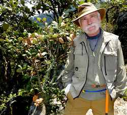
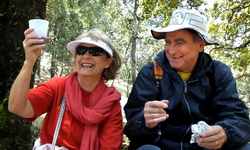
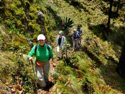
On July 17, 2016, I led members of Fuentes' support team in a
preliminary visit to the volcano for scouting purposes.
At the southwestern edge of the town of Tequila, alongside the railway
station, a cobblestone road begins and then winds its way uphill for 18
kilometers to two sets of microwave antennas which rise from opposite
ends of the crater rim.
We found the old road to be “not in the best shape,” with plenty of baches (potholes)
but not worse than many another Jalisco camino. I would say
any vehicle with good clearance can get up the volcano without a
problem.
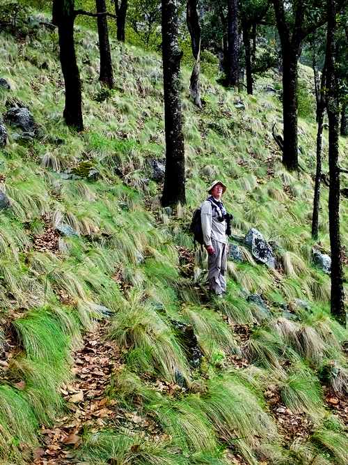
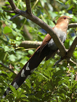
Our expedition made a stop at altitude 1500 meters where oak trees and
black cedars abounded and a playful squirrel cuckoo frolicked overhead.
From this point onwards, bunchgrass becomes more and more prevalent. At
a distance of 10.5 kilometers from the train station—altitude 2000
meters—the trees are much taller as they compete for light. Among them
is Pinus devoniana,
which produces extraordinarily long pine cones. On the roadside,
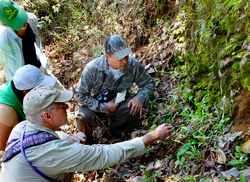
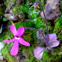
biologist Julio Álvarez spotted a number of butterworts or mountain
violets (Pinguicula),
a very curious little carnivorous plant whose leaves grow flat on the
ground and are covered with a sticky substance which traps and then
digests small insects.
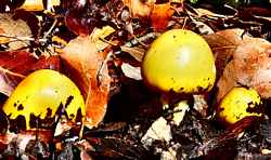
Further on, among the leaves, lay bright yellow Amanita mushrooms,
which, our biologist informed us, could be edible, poisonous or
hallucinogenic. These in particular, turned out not only to be edible,
but they were later identified as Caesar's Mushrooms (Amanita caesarea),
so called because they were a favorite of the Roman Emperor Claudius.
In Spanish they are known as Yema de Huevo, Egg Yolks.
At a distance of 15.7 kilometers from the Tequila Railway Station, our
car ride came to an end in front of a locked gate with signs warning
“private property.” Authorities in Tequila, however, informed me that
this gate is “only meant to stop cars,” due to past problems of
vandalism of the antennas. Hikers are allowed to proceed.
During the hike, our birdwatchers spotted—among others—a spotted
towhee, a slate-throated redstart and the unusually large magnificent
hummingbird.
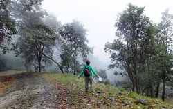
At this altitude (2700 meters) the road may suddenly be shrouded in fog
as a cloud passes by. We all found this fascinating, an experience you
can only get on a high mountain like this one. Those who were not used
to higher altitudes found themselves huffing and puffing, but we were
in no hurry, stopping again and again to photograph flowers or little
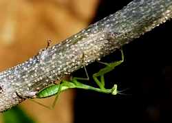
creatures like a praying mantis, a millipede and a truly curious
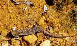
Popocatepetl Alligator Lizard (Barisia imbricata).
 After a walk
of 1.5 kilometers, we came to a trail on the left (at N20.78951
W103.84820). Follow it uphill and you will find yourself perched on the
crater rim, with the tall volcanic plug, popularly called La Tetilla,
looming above you. The trail—hard to spot when covered with
leaves—heads east and then southeast for 694 meters, plunging you into
a phantasmagorical landscape quite unlike what you would expect to see
inside a crater. The bunchgrass now dominates and all the trees are
“natural bonsais,” some barely two meters tall. Here you'll find St.
Benedict's Thistle (Cardo Santo), large Guadalajarana agaves, and a
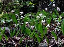
cypress tree which grows only on this volcano...and if you are lucky
you may come across a rare Govenia
purpusii orchid growing on the ground. After a walk
of 1.5 kilometers, we came to a trail on the left (at N20.78951
W103.84820). Follow it uphill and you will find yourself perched on the
crater rim, with the tall volcanic plug, popularly called La Tetilla,
looming above you. The trail—hard to spot when covered with
leaves—heads east and then southeast for 694 meters, plunging you into
a phantasmagorical landscape quite unlike what you would expect to see
inside a crater. The bunchgrass now dominates and all the trees are
“natural bonsais,” some barely two meters tall. Here you'll find St.
Benedict's Thistle (Cardo Santo), large Guadalajarana agaves, and a
cypress tree which grows only on this volcano...and if you are lucky
you may come across a rare Govenia
purpusii orchid growing on the ground.
The trail ends at the base of the plug which was pushed up from the
center of the crater about 200,000 years ago when it stopped erupting.
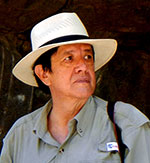
The geologist on our team, Canadian Chris Lloyd, told us that Tequila
Volcano “is an andesitic stratovolcano that formed over a period of
about 25 thousand years. It is the largest part of a volcanic
field that first started erupting about 1 million years ago and
includes the whole spectrum of volcanic rocks from basalts to
rhyolites, including various flows and domes which are rich in
obsidian. It has been estimated that a total of 128 cubic
kilometers of lava has been erupted over that 1 million years with the
actual Volcán Tequila making up about 31 of those cubic kilometers.”
Belayed by a good mountain climber, most people can scale the plug,
popularly called la
tetilla to enjoy the reward of a 360-degree view of
western Mexico from altitude 2920 meters above sea level. On a clear
day, the agave fields, stretching off into the distance, looking for
all the world like blue-green lakes.
Producer Alberto Fuentes hopes to capture the uniqueness of Tequila
Volcano on film, with the help of aerial photography, but no movie
could do it justice. So, if you're reasonably healthy, you may want to
add Tequila Volcano to your bucket list. There's no substitute for the
real thing.
How to get there
Take libre
highway 15 west from Guadalajara. As you approach the town of Tequila,
turn south onto a street called Filosofos (at N20.88048 W103.82908).
From here use Google Maps to guide you to the start of the cobblestone
road (at N20.87231 W103.84263). Drive uphill 15.7 kilometers to the
locked gate (N20.79208 W103.85348) and park. After hiking up the road
1.2 kilometers, you'll come to a crossroads. Take the right fork and
after 400 meters, at N20.78951 W103.84820, you'll see the trail head on
your left. You'll find this trail, which takes you across the crater to
the base of the plug (N20.78796 W103.84310), on Wikiloc.com under “Magic
Circle 001.” Driving time from Guadalajara to the parking
spot: about 90 minutes.
|
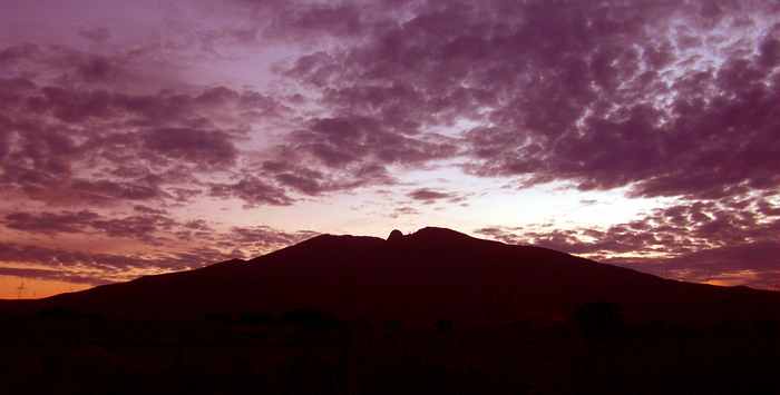
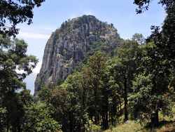 Tequila
Volcano's “tetilla” or volcanic plug is the solidified remains of the
volcano's last eruption about 200,000 years ago. Rising to a height of
nearly 3000 meters, it offers a dramatic and unique view to those who
scale it. Photo by Chris Lloyd.
Tequila
Volcano's “tetilla” or volcanic plug is the solidified remains of the
volcano's last eruption about 200,000 years ago. Rising to a height of
nearly 3000 meters, it offers a dramatic and unique view to those who
scale it. Photo by Chris Lloyd.