|
By Kiremex
 [Before submitting this excellent article, the
author suggested I investigate Wikiloc myself and try uploading,
downloading and following trails from their website. I discovered that
Wikiloc has over 800,000 members all over the world who have uploaded a
staggering 1,571,000 trails with nearly two and a half million photos
to boot. The wonderful thing is that the trails include everything from
easy walks around town for the whole family to technical climbs up
snowy mountain peaks. This means Wikiloc literally has something for
everyone: kids, hikers, cyclists, dune-buggy drivers, whatever. My
thanks to “the hiker known as KireMex.” [Before submitting this excellent article, the
author suggested I investigate Wikiloc myself and try uploading,
downloading and following trails from their website. I discovered that
Wikiloc has over 800,000 members all over the world who have uploaded a
staggering 1,571,000 trails with nearly two and a half million photos
to boot. The wonderful thing is that the trails include everything from
easy walks around town for the whole family to technical climbs up
snowy mountain peaks. This means Wikiloc literally has something for
everyone: kids, hikers, cyclists, dune-buggy drivers, whatever. My
thanks to “the hiker known as KireMex.”
John Pint]
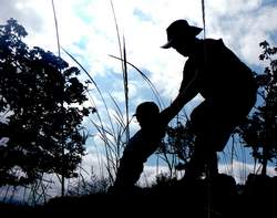
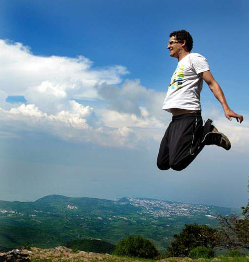
Franky Alvarez jumps for joy on a
hike from Ajijic
to Ixtlahuacan,
easy to follow thanks to Wikiloc.
A big
challenge for those of us who love outdoors in Mexico is the utter lack
of proper trails, maps or signage. Jalisco has some incredible places,
and a few select books exist, such as Outdoors
in Western Mexico, that get one really excited about the
possibilities. But while the good ones can lead you to the trailhead,
it can be a challenge to actually follow the full route.
John Pint is an incredible writer and his writings are a great
inspiration for where to search. However, even though he provides the
exact starting point, I've found out it is often too easy to get lost
on the way and not get to the desired destination. Also, because he is
a single person, it is not possible for him to document every nice
trail that exists in Mexico.
If only there were a way where each person who knew of a good hike
could share this with others including full details of the exact path,
letting one know which way to go at intersections! Fortunately now
there is. It’s called Wikiloc
and it is extremely simple, requiring very little effort to create
trails and even less effort to follow them.
“Crowdsourcing” is the practice of obtaining needed services, ideas, or
content by soliciting contributions from a large group of people and
especially from an online community. Wikipedia, the best known example
of crowdsourcing, does not rely upon any single expert, but relies upon
the many knowledgeable users of the resource who are willing to share
and thus create a resulting work that can be very strong.
Wikiloc has applied the technique of crowdsourcing to the creation of
trail sites and the accompanying smartphone applications on GPS-enabled
phones have now made it easy to find and follow trails, and almost as
easy to create new ones.
This article will be split into two parts: Finding
trails and sharing new ones.
1.
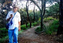
Finding and following existing trails
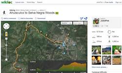
While many trail sites exist, we will focus on Wikiloc, a free service
which has the great uptake in our local community, including over 140
hiking and around 500 mountain biking trails in Jalisco, Mexico..
You can search their trails from their website
(Wikiloc.com), their smartphone app, or Google Earth (under Layers
-> Gallery -> Wikiloc). The latter actually
lets you display multiple trails on the map allowing you to plan your
own route.
Each trail will list the actual route over a map, a chart showing
elevation changes, as well as total distance, time, pace, elevation
gain/loss, whether the trip is one-way or round trip, and difficulty
level as rated by the contributor (who may have a different perspective
than your own). Waypoints may also be displayed,
each with a name and optional photos, and categorized to be an
intersection, cave, viewpoint, etc. When viewed on your smartphone, it
will state how how far you are from the starting point and in what
direction to go, making it easy to find.
Once you start following a trail it will display a map with the
original track marked in yellow and your actual route in
green. It will provide an audible reminder (a
double chime) should you get too far off trail. This combined with the
map and waypoints makes following the path very easy. Wikiloc trails
can also be downloaded to many kinds of GPS units.
2.
Creating Trails
Creating a trail using the Wikiloc app is as easy as following one.
When you arrive to the trailhead, you click Record Trail and it starts
recording. To save your battery life, we recommend turning off
non-essential things such as Wi-Fi, Bluetooth, etc. When you get to
something interesting, hit the little flag button and you have created
a waypoint. You can now categorize this, name it (Great Picnic Spot,
Peak), and optionally take some photos.
When the trail is done you stop recording, name the trip and optionally
upload the trail to the Wikiloc website (free account needed). You then
get an email confirmation of the upload which you can use to edit the
names of the waypoints, replace pictures, etc. And you get an extra
bonus for uploading. You now get notified when others upload trails
nearby, expanding your knowledge of where to go.
Wikiloc
was created in 2006 as a hobby by Catalonian Information Engineer and
mountain climber Jordi Ramot. An enthusiastic outdoorsman, Ramot got
the inspiration for this project shortly after the birth of Google
Maps. “I tried drawing routes from my GPS on a Google Map and the
results were spectacular. Later I realized I could not only show my
routes but I could allow others to share theirs.”
Ramot’s crowning
achievement came in 2008 when Google Earth agreed to
show Wikiloc trails as a default layer on Google Earth (under Gallery).
Wikiloc uses 100 percent free software. It now gets over one million
different users every month.
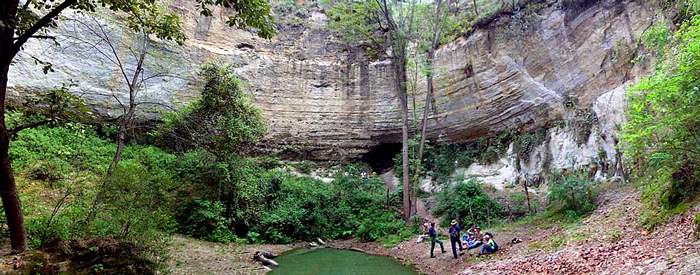
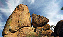
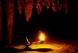
Sheltered
Spring (La Atarjea Tapada) is hidden deep inside the
Primavera Forest, but you can find your way there easily thanks to
Wikiloc. For a description of this beautiful site, see Chapter 18 of
the book Outdoors
in Western Mexico.
|