


Blow Hole Dome
West side of Eastern Province, Saudi Arabia
Summan Plateau Paleocene / Eocene Um Er Radhuma Carbonate cave
Photos by Greg Gregory unless otherwise noted
 |
09/09/04
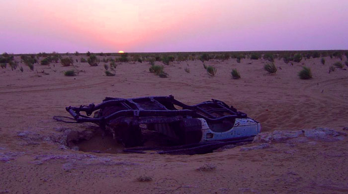
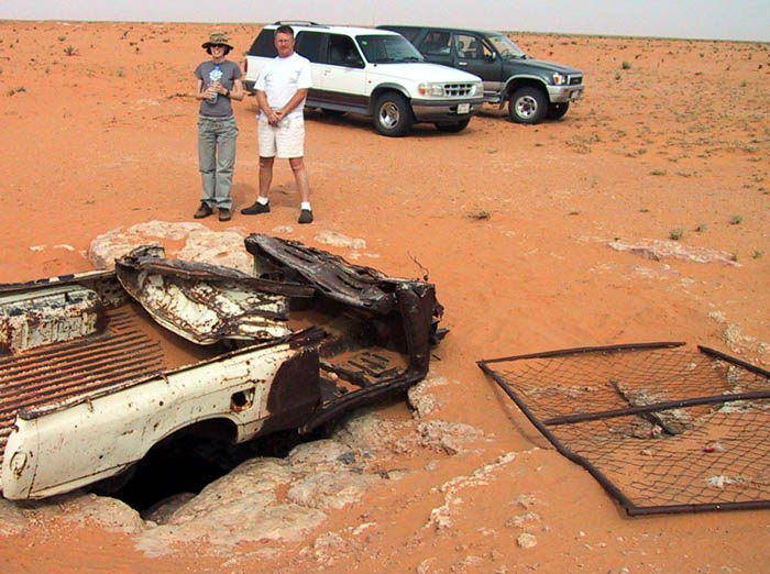
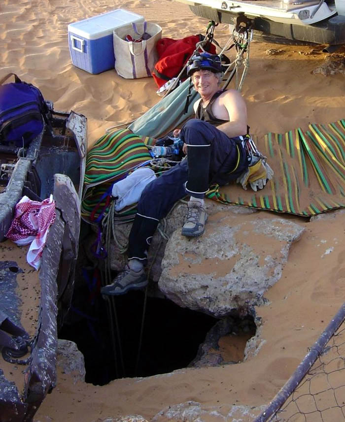
Participants: Richard Moffitt, Sally Bennett, John Weatherburn, Greg Gregory On Thursday Sept. 9 at 8am, we set off in 3 vehicles (Land Cruiser, Land Rover, 4-runner) from Dhahran commissary, bound for the newly found blowing hole cave. Richard led the way, 257 km along the Dammam - Riyadh Hwy, turning north at the Khurais turn-off, and continuing for about 95 km, along rig roads, and then minor trails and undulating sand flats for the last bit...
| ...At last, the
inverted truck body and wire fence covering the entrance came into
view. Sure enough, we get a welcome blast of cold air coming out of
the larger and 2 smaller holes, and hear the cave whistle and howl.
Any sand which slides down towards the holes is shot back up into our
faces as we peer into the inky depths...
|
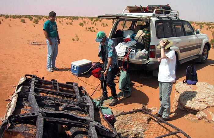 |
I rig up a couple of “long” (60m) rappel ropes, and a couple of extra ropes for aiding maneuvers near the lip, to the rear bumper and frame of the Landcruiser. The rappel ropes drop freely—it is difficult to discern if they have hit bottom. We drop a weighted string down, and we do note that eventually we hit a ledge or bottom. After all due preparations, I slide out over the lip and after my eyes adjust, I see that I’m at the top of a huge dome --- this will be a free rappel, and I see that the ropes do indeed reach the bottom of the dome. I see that I will not need a scuba mask to keep the sand out of my eyes. I climb back out, remove the mask, then return again over the lip. There are dozens of pigeons roosting about 2.5m under the lip, and they take flight within the dome at my approach...
| ...I continue
rappelling down, and eventually land on the steep, unstable flank of a
breakdown pile. After getting off rope I scamper up to a more stable
area, and break out the survey gear. It is a 21m rappel down
from the entrance. ...
|
 |
| ...I can see and
hear Richard up above, and the entrance light helps to illuminate a good
bit of the large cave...
|
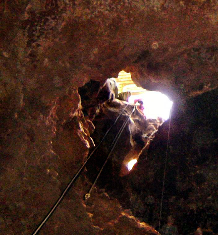 |
I can see that the cave is elongate in the N-S direction, and dropping steeply to the North, with the dome ceiling / walls also dropping. Looking up, it appears that the others are perched on a wafer-thin flake, and that the vehicles are atop a large rock wedged in the cracked dome ceiling. I imagine that it will all come crashing down any minute, and move a bit aside from the line of descent. (It is noteworthy that other one-time domes in this general area have been more readily found because they have collapsed and formed huge gaping sinkholes, containing refuse and livestock carcasses.) It is slow going getting some solo survey stations established on the steep unstable slope. Not wanting to leave everyone waiting in the 44-degree (110 F) heat at top-side too long, I opt to do a quick recon of the deeper depths – A more complete survey should be continued on the next visit.
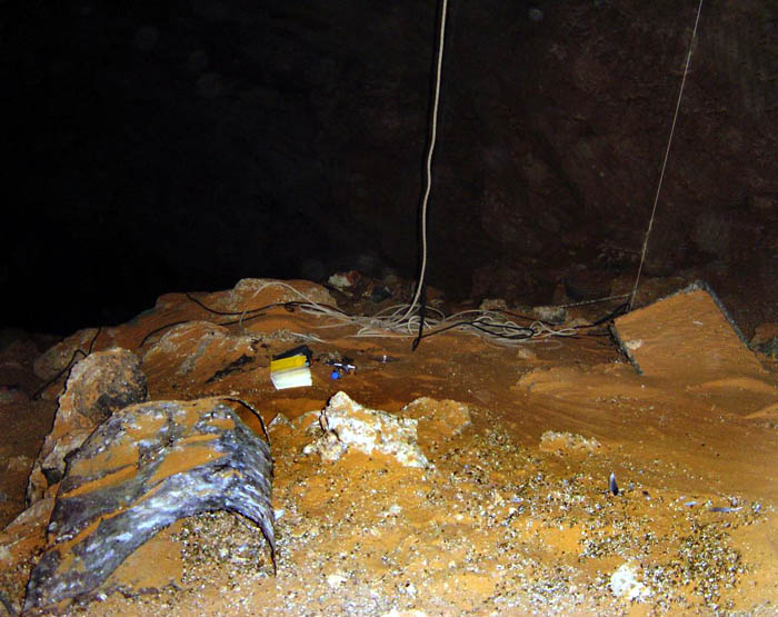
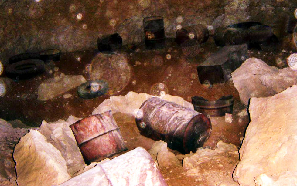
Near the bottom of the steep slope, the cave continues down to the NW, interrupted by another large break-down hill. There are at least a dozen steel barrels of some sort on the down-slope perimeter...
  Left:
View looking NNW downslope to the lower breakdown pile. Barrels are
towards the right (NE), further downslope and out of sight.The deepest
part of the cave is beyond the breakdown and further to the left (NW) with
3 to 8 + m of head room. Left:
View looking NNW downslope to the lower breakdown pile. Barrels are
towards the right (NE), further downslope and out of sight.The deepest
part of the cave is beyond the breakdown and further to the left (NW) with
3 to 8 + m of head room.
Right: close up of barrels |
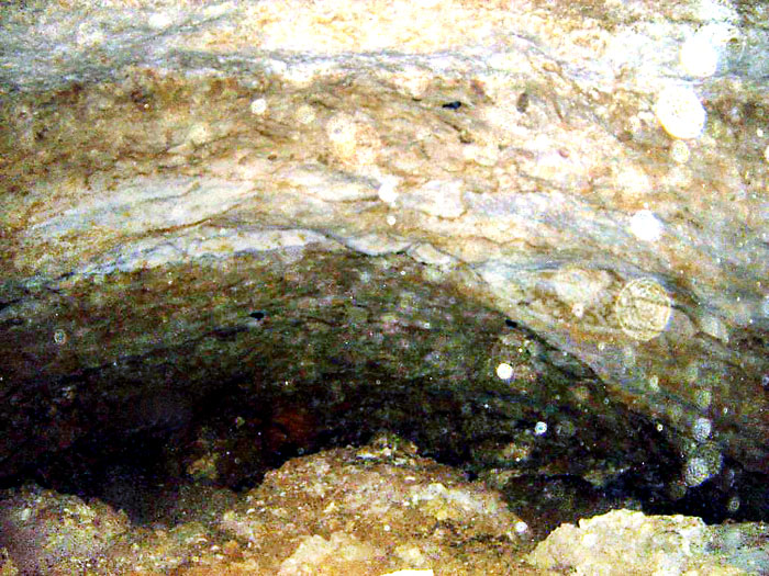
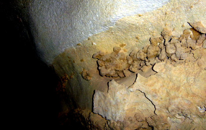
The southwest side features a rust-ochre colored gour sluice-way, a sort-of sloping rimstone dam, built up slightly on the edges and made of crystalline carbonate deposits. It appeared to be a path where water once flowed. There were also nicely decorated crystalline walls. These crystals appeared to be varieties of calcite. None of the usual large stalactites or stalagmites or traditional helictites were readily seen --- But the multi-colored crystalline walls were of great beauty and interest.
|
View of the crystal-coated walls: West side of cave, overhead. They appeared to be layered zones of mineralization, similar to the "tostadas" and crystals found in Murubbeh Cave, all of which were formed in or under water. The formations on this wall looked good enough to eat for dessert.
|
 |
| Some areas reminded me of Ice
cream cones and snow cones: A white-mint crystalline layer, then beige
vanilla, w/ clusters of nugat, caramel, and platy crunchy flakes &
sprinkles, ready to drip away from the base of the ice cream scoop...
|
 |
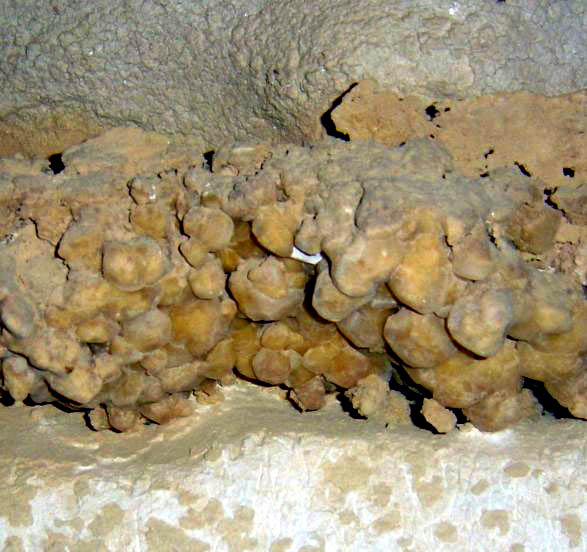 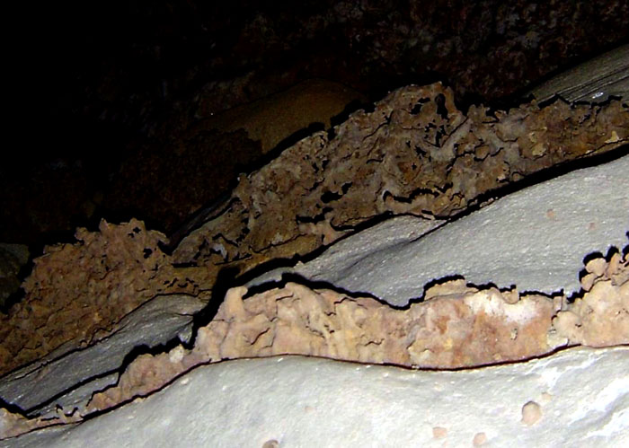
More yummy-looking formations. On the right, which is a view straight up, note the darker layers of mineralization jutting out from the crystalline walls. |
A narrow crack appeared to continue on beneath the deepest accessible part of the cave – It was too narrow to pursue. Also at the bottom back of the cave, part of the ceiling appeared to have been sooted from a fire -- possibly from a tire set on fire? The presence of the barrels and possibly a burned tire is most curious… It seems likely that I am the first visitor inside the cave, and the barrels and burning tire were probably tossed-in and slid down the talus slope. The deepest part of the cave had a lot of suspended dust, which played havoc with most photos. The temperature on the cave floor was about 30 degrees C (85 F).
 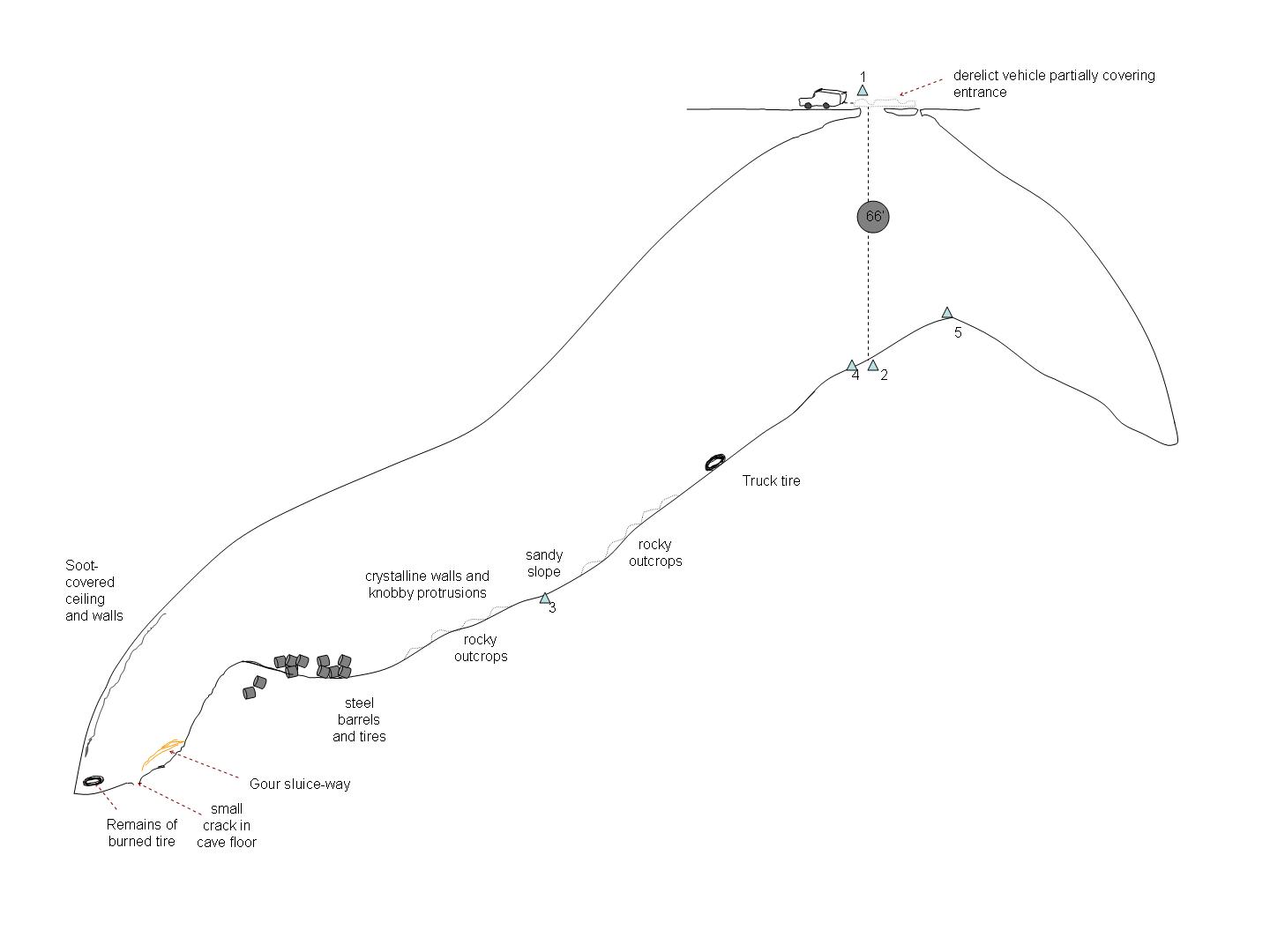
The cave is about fifteen meters wide, about 82+ meters long and about 60+ meters deep. Left: Plan map, detail Right: Profile map, detail Click on either one for a full-size map. |
Climbing back up the sliding slope was difficult and strenuous. For my ascent out of the hole, I used a traditional frog system, and I also slid an additional ascender up the second rope, as a self belay. This worked pretty well, though it makes for a slower ascent. Near the lip I clipped on an etrier to the auxiliary rope, which greatly facilitated getting back on top...
| ... It was
great to visit the blow hole dome and a great relief to make it out of
there without any problems. ...
|
 |
We camped in a nearby green brush hollow and watched shooting stars as the campfire turned to embers. The air was quite cool, in contrast to the noon-time heat. The next morning, we noted that the Ma’aqala area caves are an additional 50 km to the WNW. We opted to head back to Dhahran, and arrived just as the Friday noon prayer was letting out...
| ... Excellent
trip!!! Looking forward to the next one...
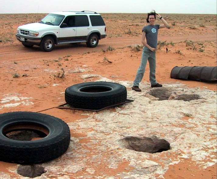
Sally Bennett cools off in the lively breeze from another, nearby, blowing hole... Hmm, now where did I put my rope? |
 |
 |
Thanks especially to Richard for letting us know about this site, and navigating the way there.
Greg Gregory
|
|